Marble 1.3.4
Author: KDEdu
Size: 25 MB
License: Freeware (Open Source)
Requires: Windows (32/64 bit) – XP/2003/Vista/7/2008, Linux, Mac OS X
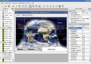
Marble is a Virtual Globe and World Atlas that you can use to learn more about Earth: You can pan and zoom around and you can look up places and roads. A mouse click on a place label will provide the respective Wikipedia article.
Of course it’s also possible to measure distances between locations or watch the current cloud cover. Marble offers different thematic maps: A classroom-style topographic map, a satellite view, street map, earth at night and temperature and precipitation maps. All maps include a custom map key, so it can also be used as an educational tool for use in class-rooms. For educational purposes you can also change date and time and watch how the starry sky and the twilight zone on the map change.
In opposite to other virtual globes Marble also features multiple projections: Choose between a Flat Map (“Plate carré”), Mercator or the Globe.The best of all: Marble is Free Software / Open Source Software and promotes the usage of free maps. And it’s available for all major operating systems (Linux/Unix, MS Windows and Mac OS X).
- Marble is cross platform and runs on Windows, Linux and Mac OS X.
- Marble runs decently even without hardware acceleration. It just uses Qt’s Arthur API as a painting backend. Optional OpenGL support is being worked on.
- Marble uses vector as well as bitmap data. Marble pulls much of its data from internet servers but can also be used offline.
- Marble provides a plugin architecture and can easily be extended for lots of use cases.
- Marble has got support for several 3rd party data sources like OpenStreetMap, Wikipedia, KML, GPX etc.
- Marble can use several projections: Globe, Flat (“Plate Carree”) and Mercator.
- Marble starts up very quickly


